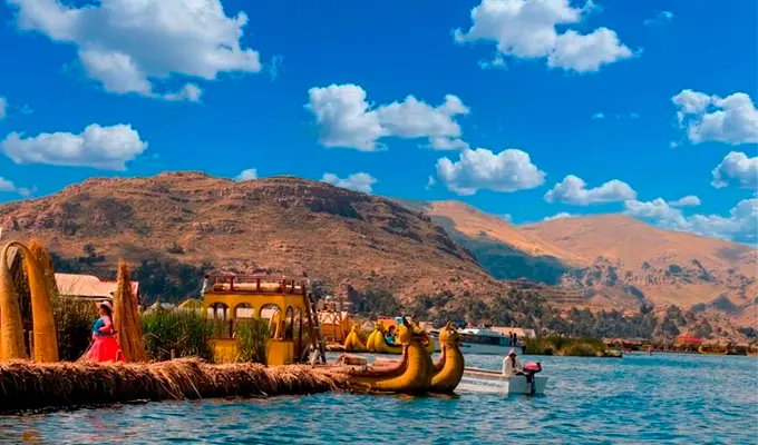
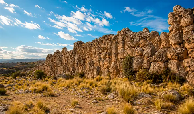
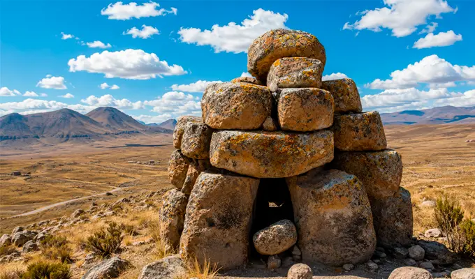
Located in the southernmost part of Puno, just a few kilometers from the border with Bolivia, the Tanka Tanka Archaeological Complex stands as one of the most fascinating and lesser-explored heritage sites in the highland region. This fortified settlement, built by the pre-Inca Lupaka lordship, impresses with its monumental dimensions and architecture, consisting of extensive defensive stone walls, chullpas or funerary towers, agricultural terraces, and ceremonial plazas that bear witness to the advanced social, military, and architectural development of this civilization.
Set within the vast expanse of the Andean landscape, Tanka Tanka is an authentic destination for enthusiasts of history, archaeology, and cultural tourism who seek to venture beyond conventional routes and connect with the ancestral heritage of the Andes.
| Fact | Information |
| Location | Zepita, Puno |
| Elevation | 3,973 m a.s.l. |
| Culture | Lupaka Lordship |
| Chronology | 1200–1500 AD |
| Cultural Heritage | Since 2001 |
| Main Attraction | Stone walls and chullpas |
The Tanka Tanka Archaeological Complex is strategically located in the district of Zepita, within the province of Chucuito, in the southern part of the Puno region. Situated approximately 15 kilometers from the town of Zepita and about 22.5 kilometers west of Desaguadero along the Binational Highway connecting with Moquegua, the site occupies a rocky elevation covering nearly 20 hectares. From this prominent position overlooking the vast highland plateau, the settlement not only benefited from natural defensive advantages but also enabled its inhabitants to exercise strict control over the surrounding territory and key communication routes.
Developed during the period of the Aymara lordships (between 1200 and 1500 AD), the complex flourished following the fall of Tiwanaku and prior to the expansion of the Inca Empire. During this period, the Lupaka society became one of the most prosperous and powerful groups in the Titicaca Basin, competing for regional dominance with other kingdoms such as the Collas, Pacajes, and Omasuyos.
Tanka Tanka was designed as a strategic center with defensive, administrative, and religious functions. Its construction on a high rocky promontory provided an almost impregnable position for monitoring the territory and protecting the population from enemy incursions. Today, the settlement stands out as one of the most remarkable and best-preserved examples of pre-Inca military architecture in southern Peru.
The origin of the name Tanka Tanka has several popular and linguistic interpretations. One of the most widespread associates its toponymy with the local fauna and geography of the area. According to this tradition, the rocky promontory on which the complex stands bears a striking resemblance to the body of a beetle locally known as tanka or jamatanka, an insect that held symbolic significance in the daily life and worldview of local communities.
Although different hypotheses exist regarding the exact etymology of the term, the name has remained unchanged over time, preserving the historical memory of this impressive archaeological site.
Among the most remarkable architectural and historical elements of the Tanka Tanka Archaeological Complex, the following structures stand out:
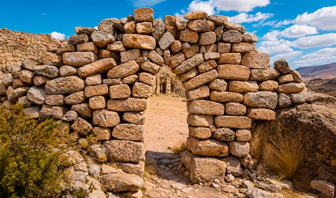
The architecture of Tanka Tanka makes intelligent use of the site's natural geography.
The structures were built on top of an enormous natural rock formation that served as the foundation for the walls and provided a commanding view of the surrounding territory.
The complex combines:
All of this demonstrates the advanced level of urban planning achieved by the Lupaka lordship.
In recognition of its historical, architectural, and social significance within the Andean highlands, the Tanka Tanka Archaeological Complex was officially declared Cultural Heritage of the Nation in 2001.
This state designation seeks to safeguard the integrity of one of the most important pre-Inca fortified complexes in southern Peru, ensuring the research, conservation, and preservation of its walls, chullpas, and archaeological remains for future generations.
To visit the Tanka Tanka Archaeological Complex from the city of Puno, there are two main travel options:
The Tanka Tanka Archaeological Complex can be visited throughout the year, adapting to the seasonal conditions of the highlands:
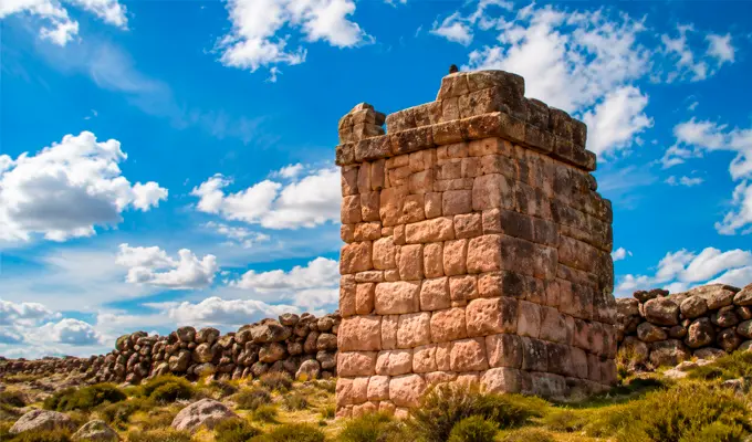
To make the most of your visit to the Tanka Tanka Archaeological Complex and ensure a safe and respectful experience, it is advisable to follow these recommendations:
Located in the southernmost part of Puno, just a few kilometers from the border with Bolivia, the Tanka Tanka Archaeological Complex stands as one of the most fascinating and lesser-explored heritage sites in the Andean highlands. This fortified settlement, built by the pre-Inca Lupaka lordship, impresses with its monumental dimensions and architecture, consisting of extensive defensive stone walls, chullpas or funerary towers, agricultural terraces, and ceremonial plazas that bear witness to the advanced social, military, and construction skills of this civilization.
Set within the vastness of the Andean landscape, Tanka Tanka offers an authentic retreat for travelers passionate about history, archaeology, and cultural tourism who wish to move beyond conventional routes and connect with the ancestral heritage of the Andes.
| Fact | Information |
| Location | Zepita, Puno |
| Altitude | 3,973 m above sea level |
| Culture | Lupaka Lordship |
| Chronology | 1200–1500 AD |
| Cultural Heritage | Since 2001 |
| Main attraction | Defensive walls and chullpas |
The Tanka Tanka Archaeological Complex is strategically located in the district of Zepita, within the province of Chucuito, in the southern part of the Puno region. Situated approximately 15 kilometers from the town of Zepita and about 22.5 kilometers west of Desaguadero along the Binational Highway connecting to Moquegua, the site occupies a rocky elevation covering approximately 20 hectares. From this dominant promontory overlooking the vast Andean plateau, the settlement not only benefited from natural defensive advantages but also allowed its inhabitants to maintain close control over territorial movement and key communication routes in the surrounding area.
Developed during the period of the Aymara lordships, between 1200 and 1500 AD, the complex flourished following the decline of Tiwanaku and before the expansion of the Inca Empire. During this period, the Lupaka society became one of the most prosperous and powerful groups in the Lake Titicaca basin, competing for regional dominance with other kingdoms such as the Collas, Pacajes, and Omasuyos.
Tanka Tanka was designed as a strategic center with defensive, administrative, and religious functions. Its construction on a high rocky promontory provided an extremely defensible position for monitoring the territory and protecting the population from enemy incursions. Today, the settlement stands as one of the most remarkable and best-preserved examples of pre-Inca military architecture in southern Peru.
The origin of the name Tanka Tanka has several popular and linguistic interpretations. One of the most widespread connects its toponymy with the local fauna and geography of the area. According to this tradition, the rocky promontory on which the complex stands bears a striking resemblance to the body of a beetle locally known as tanka or jamatanka, an insect that held symbolic significance in the daily life and worldview of local communities.
Although different hypotheses exist regarding the exact etymology of the term, the name has remained unchanged over time, preserving the historical memory of this imposing archaeological site.
Among the most remarkable architectural and historical features of the Tanka Tanka Archaeological Complex are the following structures:
The architecture of Tanka Tanka makes intelligent use of the site's natural geography.
The structures were built on top of a massive natural rock formation that served as a foundation for the walls and provided a commanding view of the surrounding territory.
The complex combines:
All of this demonstrates the advanced level of urban planning achieved by the Lupaka lordship.
In recognition of its historical, architectural, and social significance within the Andean highlands, the Tanka Tanka Archaeological Complex was officially declared Cultural Heritage of the Nation in 2001.
This state designation seeks to safeguard the integrity of one of the most important pre-Inca fortified complexes in southern Peru, ensuring the research, conservation, and preservation of its walls, chullpas, and archaeological remains for future generations.
To visit the Tanka Tanka Archaeological Complex from the city of Puno, there are two main travel options:
The Tanka Tanka Archaeological Complex can be visited throughout the year, adapting to the seasonal conditions of the Andean highlands:
To make the most of your visit to the Tanka Tanka Archaeological Complex and ensure a safe and respectful experience, it is advisable to follow these recommendations:
After exploring the Tanka Tanka Archaeological Complex, a journey through southern Puno allows visitors to discover a series of historically, naturally, and religiously significant attractions in the Andean highlands:
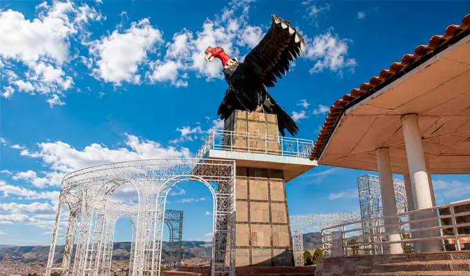
Located on one of the most prominent elevations of the city of Puno, the Kuntur Wasi Viewpoint, a name that translates from Quechua as "Condor's House", stands as the perfect gateway to understanding the geographical and cultural magnitude of the Peruvian Altiplano. This strategic site not only serves as the ideal natural viewpoint for appreciating the contrast between the urban landscape and the vastness of Lake Titicaca, but also pays tribute to one of the most sacred symbols of Andean cosmology.
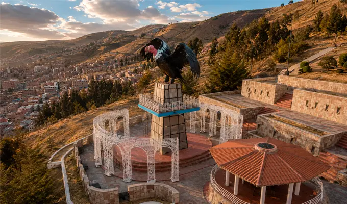
Crowned by a monumental sculpture of a condor with its wings fully spread in a flying position, the site invites travelers to connect with the region's history, local art, and sacred landscapes. Whether you are looking for your bearings before beginning a tour of the city or hoping to watch the sunset over the world's highest navigable waters, Kuntur Wasi is an essential first stop for those seeking a comprehensive and majestic perspective of Puno.
| Fact | Information |
| Location | Puno, Peru |
| Altitude | 3,990 m above sea level |
| Meaning | Condor's House |
| Inauguration | 2003 |
| Main attraction | 11-meter-tall condor sculpture |
| Best time to visit | Sunset |
The name of this iconic viewpoint has its roots in the ancestral language of the Andes, combining two Quechua words with deep symbolic meaning: Kuntur, which refers to the majestic Andean condor, and Wasi, which translates as "house" or "home." Thus, Kuntur Wasi means "Condor's House", a name that goes beyond geography to become a sincere tribute to one of the most impressive creatures of the American highlands.
Within Andean cosmology, this name carries sacred significance. The condor was not simply a bird, but the supreme messenger and the entity connecting the earth with the heavens. Within the conception of a universe divided into three realms, it was revered as the absolute guardian of the Hanan Pacha, the upper world of the gods and stars, acting as a spiritual bridge between the earthly realm (Kay Pacha) and the celestial forces. Naming this summit in its honor gives Puno a space for historical, spiritual, and scenic connection with its ancestral roots.
Inaugurated in 2003, the Kuntur Wasi Viewpoint was created with the aim of giving Puno a new space where the local community and visitors could connect with the vastness of the highland landscape. Since then, this elevated spot has become an essential stop for admiring the city from a unique perspective.
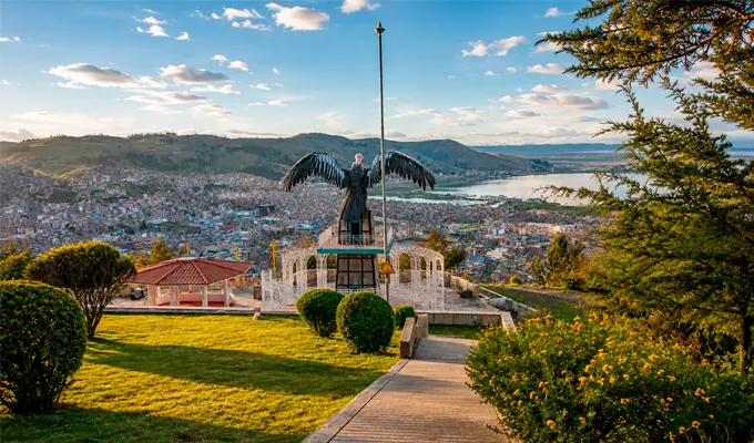
The main attraction is an imposing steel sculpture approximately 11 meters tall. The figure of the condor, built with its wings spread wide on a stone pedestal, dominates the horizon, creating the impression that it is about to take flight. More than a monument, this icon has become a symbol of Puno's identity and the undisputed guardian of the views over Lake Titicaca.
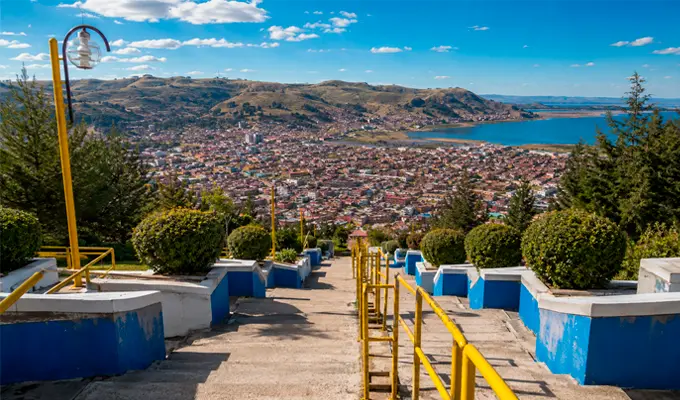
Located to the southwest of the city, just two kilometers from the Plaza de Armas and at nearly 3,990 meters above sea level, this viewpoint offers an unparalleled natural balcony over the Altiplano. Its privileged elevation allows visitors to admire, in a single glance, the contrast between urban life and the vastness of nature.
From the viewing platforms, spectacular views open up toward:
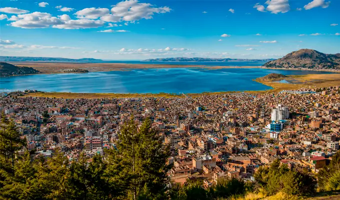
The Kuntur Wasi Viewpoint brings together a variety of architectural, natural, and scenic attractions that make it a must-see stop:
There are two main options for reaching the Kuntur Wasi Viewpoint, depending on each traveler's preferred means of transportation and pace:
In the Andean worldview, the condor is much more than a representative figure: it embodies wisdom, strength, and the spiritual connection between the sky and the earth.
Together with the puma and the serpent, it forms the emblematic sacred trilogy of the Andes, where each guardian watches over a different realm of existence:
For this reason, the monumental figure that crowns Kuntur Wasi is not merely a decorative element in the landscape, but a powerful symbol of the cultural identity, faith, and ancestral memory that remain deeply rooted among the peoples of the highlands.
The Kuntur Wasi Viewpoint is accessible year-round, adapting to the different seasons of the highlands:
To make the most of your visit to the Kuntur Wasi Viewpoint and avoid difficulties caused by the altitude or highland weather, it is advisable to keep the following recommendations in mind:
After visiting the Kuntur Wasi Viewpoint, your sightseeing route can continue by exploring the main historical, natural, and cultural attractions offered by the city of Puno and its surroundings:
The Plaza de Armas of Puno is the beating heart of the Altiplano, where the city's daily life, history, and devotion come together. Surrounded by elegant colonial mansions and watched over by the impressive stone façade of the Cathedral, this square is not only the geographical center of Puno but also the gateway to the magic of Lake Titicaca.
Walking along its stone pathways allows visitors to experience the rhythm of Peru’s folklore capital. During the day, it is the perfect place to relax under the Andean sun or enjoy a coffee at one of the nearby cafés. During celebrations such as the renowned Festival of the Virgin of Candelaria, the square transforms into a vibrant stage filled with music, colorful costumes, and ancestral dances that showcase the region’s extraordinary cultural heritage.
| Fact | Information |
| Location | Historic Center of Puno |
| Founded | 1668 |
| Main Attraction | Puno Cathedral |
| Architectural Style | Colonial and Republican |
| Most Important Event | Festival of the Virgin of Candelaria |
| Admission | Free access throughout the day |
The history of the Plaza de Armas of Puno is closely tied to the Spanish founding of the city in 1668. From its earliest colonial years, the square was designed as the administrative, religious, and commercial center of the city, following the classic urban planning model established by the Spanish Crown throughout the cities of the Viceroyalty of Peru.
Over the centuries, the square has adapted to different historical periods while preserving its identity. Throughout the 20th century, landscaped gardens, ornamental lighting, and a central fountain were added, becoming iconic features of the city's main gathering place. More recent restoration projects have focused on preserving its traditional character while expanding pedestrian areas, reinforcing its role as a harmonious meeting point where architectural heritage, major celebrations, and the everyday rhythm of the Peruvian Altiplano come together.
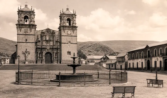
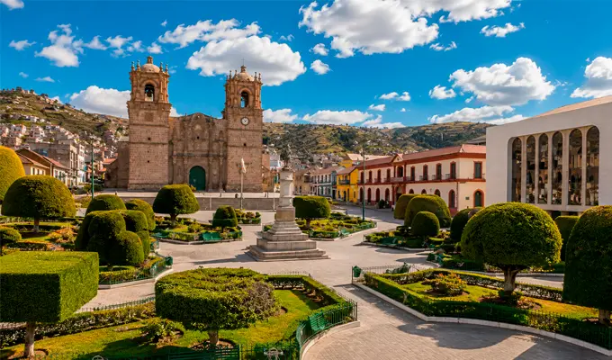
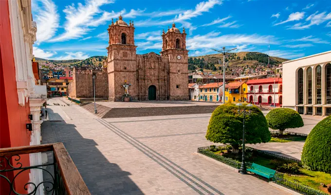
Located in the heart of Puno's Historic Center, the square sits directly in front of the impressive Minor Basilica of Saint Charles Borromeo, better known as the Puno Cathedral.
Its strategic location makes it the ideal starting point for exploring the city on foot. From the square, visitors can easily reach several of Puno's most iconic attractions, including:
In addition, the square serves as the main gateway for travelers, functioning as the usual meeting point for transfers and excursions to the legendary Uros Floating Islands, Taquile, Amantaní, and other attractions on Lake Titicaca.
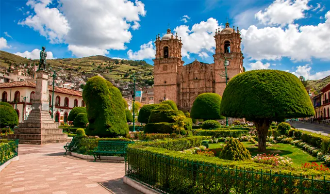
The architectural ensemble and the elements that make up the Plaza de Armas of Puno reflect the rich heritage and unique beauty of the Peruvian Altiplano:
Visiting the Plaza de Armas is one of the best ways to experience the authentic atmosphere and daily rhythm of Puno. During your visit, you can enjoy a variety of activities:
During the Festival of the Virgin of Candelaria, recognized as an Intangible Cultural Heritage of Humanity by UNESCO, the Plaza de Armas becomes the spiritual and festive heart of the celebration. The square transforms into an impressive open-air stage where thousands of dancers and musicians parade wearing dazzling embroidered costumes, elaborate masks, and traditional attire.
Amid the sound of brass bands, traditional melodies, and the ringing of the Cathedral bells, the square hosts both the solemn processions honoring the beloved "Mamita de la Candelaria" and the energetic performances of Diablada, Morenada, Caporales, and other traditional Andean dances. This spectacular celebration of music, faith, and color attracts visitors from around the world, transforming Puno's historic center into the undisputed Folklore Capital of Peru.
The Plaza de Armas of Puno offers a different atmosphere throughout the day and across the seasons, making every visit a unique experience:
The architectural landmarks and surrounding attractions near the Plaza de Armas showcase the remarkable cultural and historical richness of the Peruvian Altiplano:
To ensure a comfortable and rewarding experience while exploring Puno's Main Square and its surroundings, keep the following recommendations in mind:
On the shores of the majestic Lake Titicaca, the Capachica Peninsula stands out as one of the best-kept and most authentic treasures of Puno. This remarkable destination blends postcard-worthy landscapes, crystal clear beaches, and small communities that still live according to their ancestral traditions, welcoming visitors through community-based tourism to share the true essence of the Altiplano.
Unlike the more frequently visited routes around Lake Titicaca, Capachica offers a peaceful, authentic experience in perfect harmony with nature. It is the ideal place to disconnect from the rush of everyday life, embrace the warmth of its people, and admire some of the most breathtaking sunsets in southern Peru.
The Capachica Peninsula extends gracefully into the waters of Lake Titicaca, northwest of the city of Puno. Located just 62 kilometers (39 miles) from downtown Puno and at an altitude of approximately 3,880 meters (12,730 feet), this peninsula is home to several rural communities that have preserved their traditional way of life. Here, everyday life unfolds at a slower pace among farmland, artisanal fishing, handwoven textiles rich in history, and welcoming community-based tourism experiences.
| Fact | Information |
| Location | Puno, Peru |
| Altitude | 3,880 m (12,730 ft) |
| Distance | 62 km (39 mi) from Puno |
| Main Attraction | Community-Based Tourism |
| Notable Communities | Llachón, Ccotos, Chifrón |
| Best Time to Visit | May to October |
Since pre-Hispanic times, the Capachica Peninsula has been home to communities deeply connected to the cultures that flourished along the shores of Lake Titicaca. Century after century, its inhabitants have carefully preserved their most cherished traditions: respectful farming practices, fishing in traditional boats, handwoven textile craftsmanship, and ceremonies honoring the Pachamama, or Mother Earth.
Today, Capachica does not preserve its heritage behind museum walls it lives it every day. Through community-based tourism, local families warmly open their homes to visitors, inviting them to experience their daily routines, enjoy homemade meals, and discover the hospitality of an Andean culture that continues to thrive.
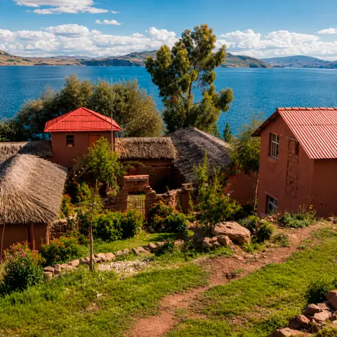
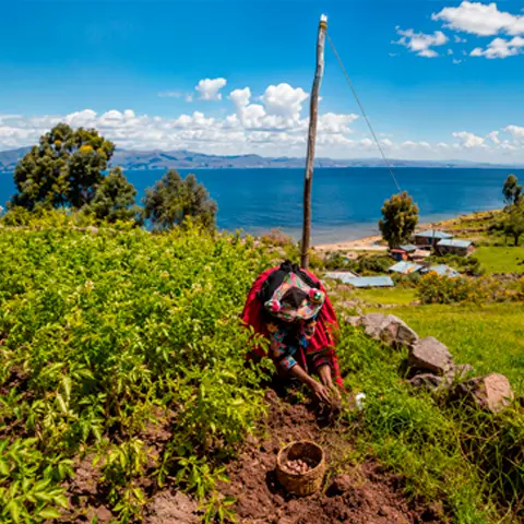
The true charm of Capachica lies in the natural way its stunning landscapes blend with the daily lives of its people. Visiting the peninsula means stepping into a world where time moves more slowly. You'll see local residents sailing traditional boats, cultivating the land using ancestral farming techniques, and weaving colorful textiles rich in symbolism and cultural heritage.
The tranquility of its lakeshore, combined with the warmth and hospitality of the families who welcome visitors into their homes, makes the peninsula a perfect retreat. It is the ideal destination for travelers seeking an authentic experience away from mass tourism and looking to connect deeply with the spirit of the Peruvian Altiplano.
The Capachica Peninsula has become one of the leading destinations for community-based rural tourism on Lake Titicaca. The concept is simple yet meaningful: local families welcome travelers into their homes, inviting them to become part of everyday life in the Altiplano.
During your stay, you can immerse yourself in local traditions through experiences such as:
More than just a trip, it is a genuine cultural exchange where every visit directly supports the local economy and contributes to the sustainable development of community families.
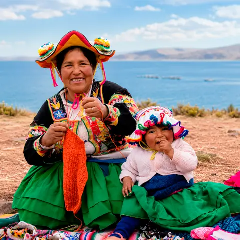

The peninsula is home to several communities, each with its own unique character and charm:
Although most travelers associate Lake Titicaca with its famous floating islands, the Capachica Peninsula is home to some of the most beautiful and surprising beaches in the entire Altiplano.
Among the most outstanding are:
The calm waters and breathtaking scenery make these hidden gems the perfect place to unwind, capture stunning photographs, or simply admire the spectacular landscape.
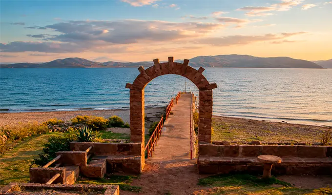
Textile art on the Capachica Peninsula goes far beyond handicrafts it is one of the region's most vibrant cultural expressions and a vital source of income for local families. Using ancestral techniques passed down through generations, artisans work on traditional looms to create remarkable handmade garments. Every woven belt, poncho, chullo (Andean knitted hat), and blanket features geometric patterns and symbolic designs whose colors reflect nature, the Andean worldview, and the rich history of the peoples of Lake Titicaca.
However, the peninsula's cultural richness extends well beyond its textiles. Throughout the year, its communities keep their collective heritage alive through traditional festivals, mystical folk dances, and ceremonies honoring Pachamama (Mother Earth) and Mamacocha (the Sacred Lake). These living traditions offer travelers an authentic and immersive experience of the true identity of Peru's Altiplano.
The cuisine of Capachica reflects both the generosity of its fertile land and the richness of Lake Titicaca. Local dishes are prepared with fresh, locally sourced ingredients cultivated using traditional farming methods, resulting in honest, flavorful, and comforting cuisine.
Some of its most representative specialties include:
The most special part of this culinary experience is that most rural lodges prepare their meals using freshly harvested vegetables from their own gardens and fish caught the very same day, ensuring every dish is fresh, natural, and homemade.
During your stay on the peninsula, each day offers a different way to connect with the natural surroundings and the local communities. Some of the most memorable experiences include:
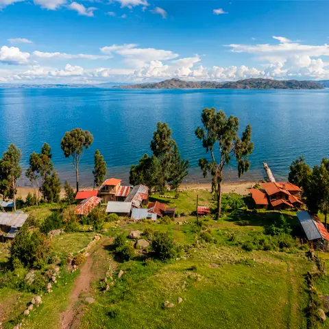
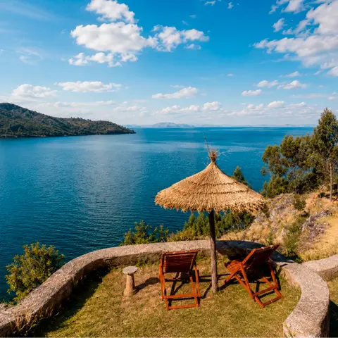
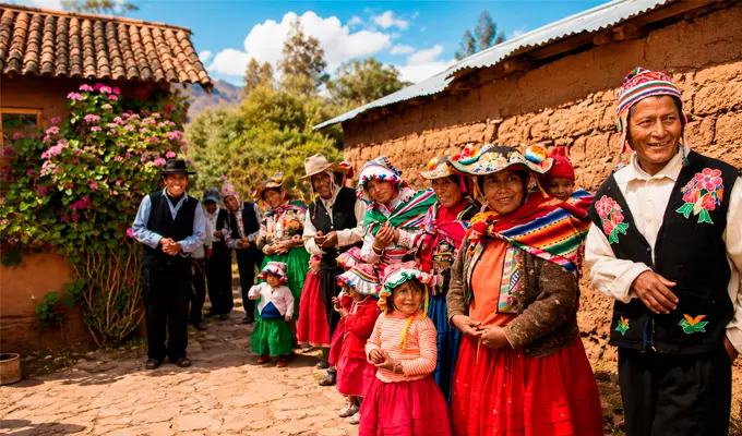
There are a couple of ways to reach and enjoy the peninsula, depending on your travel style:
The ideal time to discover the beauty and tranquility of the Capachica Peninsula is between May and October, during the Altiplano's dry season. Throughout these months, visitors enjoy pleasant weather with sunny days, warm sunshine, and crystal-clear blue skies that seem to merge seamlessly with the waters of Lake Titicaca.
These conditions are perfect for making the most of your visit. They allow you to hike the lakeside trails comfortably, enjoy boat excursions without worrying about rainfall, and capture unforgettable photographs under exceptional natural light. Although nighttime temperatures can drop significantly due to the high altitude, the clear days and the peaceful atmosphere of the lake make the experience truly worthwhile.
To make the most of your visit while respecting both yourself and the destination, keep these recommendations in mind:
Why should I visit Capachica?
To enjoy an authentic community-based tourism experience, sharing traditions and everyday life with local families in a unique natural setting.
How long should I stay?
Although it can be visited on a day trip, it is highly recommended to stay at least one night to fully experience the destination and enjoy the spectacular sunsets over Lake Titicaca.
Which community is the most visited?
Llachón, as it pioneered community-based accommodations and offers spectacular hiking trails and viewpoints overlooking Lake Titicaca.
Can I visit all year round?
Yes. However, the dry season (May to October) is considered the best time to visit thanks to its sunny days and clear skies.
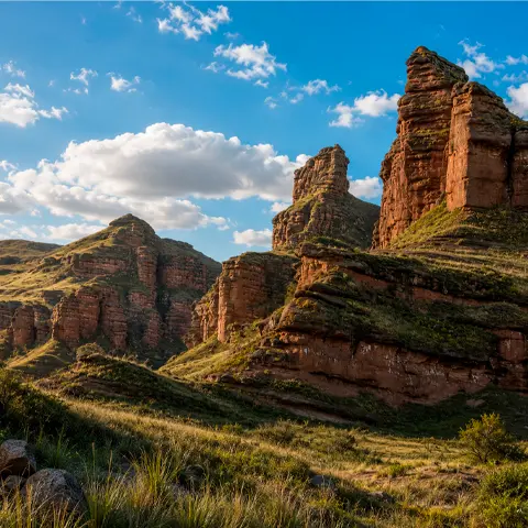
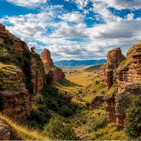
Hidden in the heart of the Melgar Province in Puno lies one of Peru’s most breathtaking natural wonders: Tinajani Canyon. This spectacular landscape is famous for its colossal reddish rock towers and walls, patiently sculpted by wind and water over millions of years into an extraordinary "stone forest" that looks as if it belongs to another planet.
But Tinajani is much more than an impressive landscape. Walking along its trails means stepping into a land wrapped in ancient legends, dotted with archaeological remains, and enriched by a vibrant cultural heritage. It is the perfect destination for travelers seeking untouched nature, adventure, and the enduring mysteries of the Andean Altiplano.
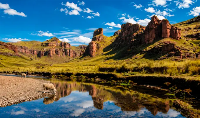
Tinajani Canyon covers approximately 250 hectares of breathtaking natural scenery at an altitude of 3,953 meters (12,969 feet) above sea level. Here, massive reddish sandstone formations rise dramatically, creating labyrinths, narrow gorges, and towering stone walls. Over countless centuries, wind, water, and time have carved the rock into shapes that resemble people, animals, castles, and monumental sculptures.
This unique combination of wild beauty and mysterious atmosphere makes Tinajani far more than just a scenic destination it is one of the most remarkable and unforgettable natural attractions in the Puno region.
The canyon is located in the peaceful community of Tinajani, within the Ayaviri District in the Melgar Province of Puno. It lies only 14 kilometers (8.7 miles) from downtown Ayaviri and approximately two and a half hours from the city of Puno by road. To reach the site, simply follow the Interoceanic Highway South and take the clearly marked turnoff leading directly to this spectacular natural viewpoint.
Quick destination facts:
Geological studies reveal that millions of years ago this remarkable landscape formed part of the ancient Lake Ballivián, the enormous prehistoric lake that existed before today's Lake Titicaca. As the waters gradually receded, tectonic activity combined with the relentless forces of wind and rain carved the monumental reddish sandstone columns and cliffs that define the canyon today.
However, Tinajani's history extends beyond geology. Hidden among its towering rock formations are small archaeological remains, including ancient chullpas (funerary towers), silent evidence that this sacred landscape was inhabited and revered by Andean civilizations long before the arrival of the Incas.
| Fact | Information |
| Location | Ayaviri, Puno |
| Elevation | 3,953 m (12,969 ft) |
| Area | 250 hectares |
| Main Attraction | Stone Forest |
| Rock Formations | Over 50 meters high |
| Best Time to Visit | April to October |
Exploring Tinajani is a unique experience where breathtaking natural scenery blends seamlessly with Andean mysticism. Some of its highlights include:
Despite the harsh highland environment, life thrives in Tinajani in a remarkable way. The reddish landscape is complemented by the golden hues of ichu grass and the resilience of small Polylepis (queñua) forests, ancient trees that flourish despite the high altitude.
If you walk quietly, you'll likely encounter herds of llamas and alpacas grazing peacefully, or even spot graceful wild vicuñas. Overhead, Andean birds soar across the canyon, bringing movement and life to its vast landscapes.
Tinajani's towering rock formations are steeped in ancient legends that have been shared around the fire for generations:
Stories like these reveal that Tinajani is much more than a geological wonder. It is a sacred place where imagination, mythology, and the Andean worldview give every corner of the landscape its own unique spirit.
Tinajani Canyon offers a wide range of activities for travelers looking to immerse themselves in nature and adventure:
From Puno:
Take the Southern Interoceanic Highway toward the town of Ayaviri. Once there, you can hire a taxi or take a local shared vehicle from the main square or bus terminal to reach the canyon in about 20 minutes (approximately 14 kilometers away). You can also join a full-day tour from Puno that includes transportation and a professional guide.
If you are traveling from Cusco:
Take the paved highway connecting Cusco and Puno (part of the Southern Interoceanic Highway). Travel south through Sicuani until you reach Ayaviri, then follow the signposted detour leading to the canyon. The journey takes approximately 5 hours, but it is a scenic drive that passes through some of the Altiplano's most iconic landscapes, including La Raya Pass and the vast plains of Puno.
The best time to explore Tinajani Canyon is during the dry season, from April to October. During these months, the Altiplano enjoys clear blue skies and bright sunshine that enhance the striking reddish tones of the canyon's sandstone formations.
This is the ideal season for hiking without worrying about sudden rain showers, capturing spectacular photographs, and enjoying the canyon's scenic trails and breathtaking panoramic views under excellent weather conditions.
To make the most of your adventure in Tinajani Canyon and stay comfortable in the high Andes, keep these recommendations in mind:
Why is Tinajani Canyon famous?
It is renowned for its colossal reddish sandstone formations sculpted by millions of years of erosion, its dramatic and almost mystical landscapes, the fascinating local legends surrounding the site, and the ancient archaeological remains and burial structures scattered throughout the canyon.
How long does the visit take?
A typical visit lasts between 2 and 3 hours, allowing plenty of time to hike through the ravines, take photographs, and explore the canyon's most remarkable landmarks at a relaxed pace.
Is it necessary to hire a guide?
Hiring a guide is not mandatory, but it is highly recommended. A knowledgeable local guide will help you navigate the trails while bringing the landscape to life through stories about its geology, history, and traditional Andean legends.
Can Tinajani Canyon be visited year-round?
Yes. The canyon is accessible throughout the year. However, the dry season (April to October) offers the best conditions, with clear skies, dry trails, and more comfortable weather for hiking and enjoying the spectacular scenery of the Altiplano.
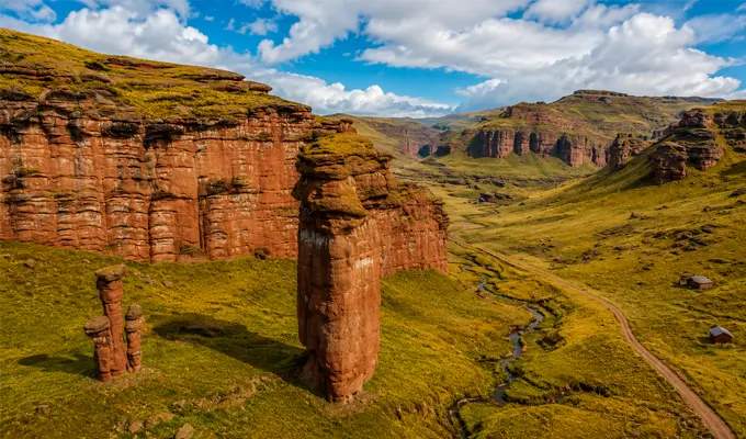
On the shores of Lake Titicaca, in the picturesque town of Chucuito, lies one of the most fascinating places in the Peruvian Altiplano: the Temple of Fertility, popularly known as Inca Uyo. This archaeological complex immediately catches the eye with its dozens of phallic-shaped stone sculptures, a unique feature that has fueled the curiosity of travelers, researchers, and archaeologists for decades.
Beyond its striking appearance, Inca Uyo is a remarkable reflection of the Andean worldview. For the ancient cultures of the Altiplano, fertility was never a taboo but rather the sacred force that sustained life itself, deeply connected to the worship of Pachamama, abundant harvests, and harmony with nature.
The Temple of Fertility is an archaeological site covering approximately 200 square meters, enclosed by carefully carved stone walls. Inside stand around 80 phallic stone sculptures, believed to have been ancient symbols dedicated to human fertility and agricultural abundance.
Although popularly known as the "Temple of Fertility," historians and archaeologists generally refer to the site as Inca Uyo. Rather than being an unusual attraction, it was a sacred sanctuary where rituals honoring Pachamama were performed to maintain harmony with the natural cycles and forces of the earth.
The temple is located in the charming district of Chucuito, just 18 kilometers (11 miles) south of Puno and only a short distance from the shores of Lake Titicaca. Thanks to its convenient location and easy access, it is one of the region's favorite day trips.
Quick Destination Facts:
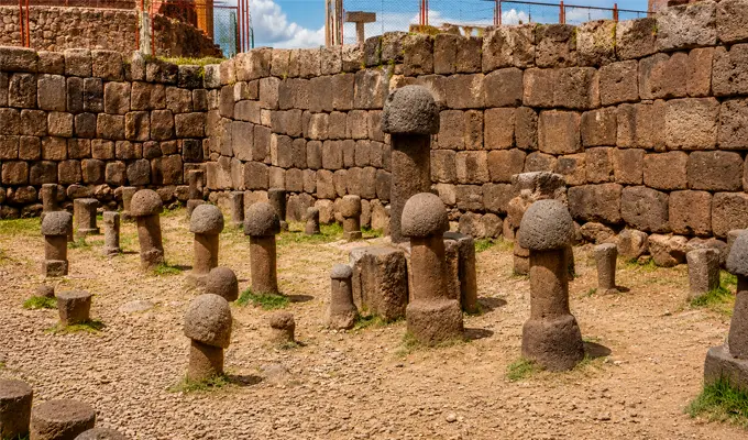
The exact origin of Inca Uyo remains something of a mystery. However, archaeological research suggests that it functioned as an ushnu, or ceremonial altar, dedicated to agricultural rituals intended to ensure the fertility of the land. Over time, this devotion to agricultural abundance naturally became associated with human fertility, giving rise to the traditions and stories that the local community still preserves today.
Today, the site is considered one of the most unique and fascinating archaeological attractions in the Altiplano, preserving an important part of the region's cultural heritage.
| Fact | Information |
| Location | Chucuito, Puno |
| Elevation | 3,875 m (12,713 ft) |
| Original Name | Inca Uyo |
| Main Attraction | More than 80 stone sculptures |
| Distance from Puno | 18 km (11 miles) |
| Best Time to Visit | May to October |
The name Inca Uyo comes from the Aymara language and is commonly translated as "the Inca's virile member." This name directly reflects the site's distinctive stone sculptures and the profound symbolic importance that fertility held in the Andean world.
For the civilizations of the Altiplano, fertility extended far beyond human reproduction. It represented the vital force that ensured plentiful harvests, thriving livestock, and the continuous cycle of life sustained by Pachamama, or Mother Earth.
The heart of Inca Uyo lies in its collection of more than 80 stone sculptures scattered throughout the site. Although they vary in size and shape, they all share the same sacred symbolism related to life, fertility, and the deep connection between the Andean people and nature.
Far from being simple decorative carvings, these stones played a central role in ancient ceremonies. Community members gathered here to pray for abundant harvests, pay tribute, and express gratitude to Pachamama for the food and prosperity she provided.
Numerous legends have been passed down through generations about Inca Uyo. One of the most popular tells of women who wished to become mothers visiting the sanctuary to perform small fertility rituals, offering coca leaves and corn chicha while praying to be blessed with children.
Although these stories add a mystical atmosphere to the site and remain an important part of Chucuito's rich folklore, they should be understood as traditional beliefs rather than historical facts. Archaeological research has found no conclusive evidence supporting these legends, but they continue to be a valuable part of the Altiplano's oral heritage.
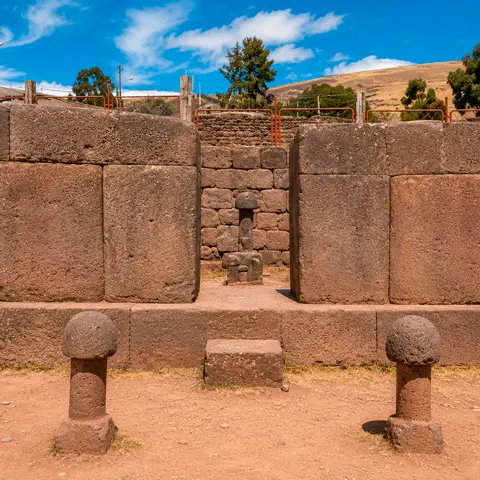
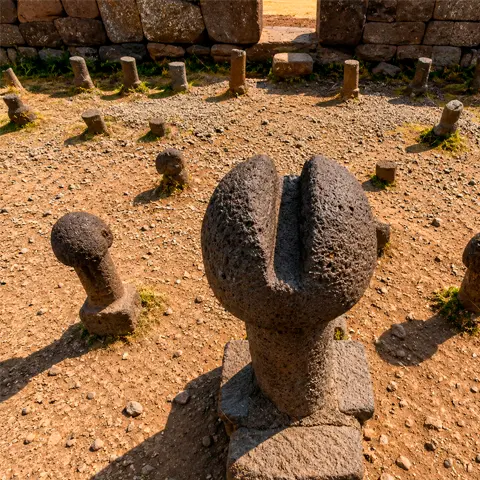
Although it may seem like a modest archaeological site at first glance, the architecture of Inca Uyo is both simple and deeply symbolic. The entire complex is enclosed by carefully carved stone walls that surround a central courtyard, the heart of the temple where the famous stone sculptures are arranged.
This layout was far from accidental. It reflects the remarkable engineering skills of the ancient peoples of the Altiplano while emphasizing the site's ceremonial importance. Some researchers also believe that the orientation of its walls and architectural elements was aligned with astronomical observations, serving as a guide for marking the seasons and the agricultural calendar.
Chucuito is a destination full of surprises. While the Temple of Fertility (Inca Uyo) and its famous stone sculptures are the main attraction, the town also offers several charming places worth exploring:
Getting there from Puno is quick and easy, making it an excellent half-day excursion. You can choose from several transportation options depending on your travel style:
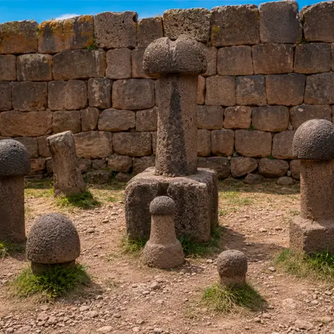
The site is open to visitors throughout the year, but the dry season (May to October) offers the best experience. During these months, you'll enjoy sunny days, clear blue skies, and ideal weather for appreciating the stunning landscapes of the Altiplano.
For the most pleasant visit, plan to arrive in the morning or early afternoon. These hours offer cooler temperatures, excellent lighting for photography, and generally calmer conditions before the chilly evening winds arrive.
To make the most of your visit while helping preserve this important archaeological site, keep these practical recommendations in mind:
Why is it called the Temple of Fertility?
Its stone sculptures have traditionally been associated with rituals dedicated to the fertility of the land and human reproduction, both of which were fundamental elements of the Andean worldview.
What does Inca Uyo mean?
The name comes from the Aymara language and is commonly translated as "the Inca's virile member", a direct reference to the symbolic meaning of the carved stone sculptures found within the site.
How long does the visit take?
A visit to the archaeological site usually takes between 30 and 60 minutes. However, you'll get much more out of the experience by spending a couple of hours exploring the charming town of Chucuito and enjoying its scenic viewpoints.
Is Inca Uyo worth visiting?
Absolutely. It is one of the most unique archaeological attractions in Puno, offering fascinating insights into the rituals, spirituality, and close relationship that the ancient peoples of the Altiplano maintained with nature.
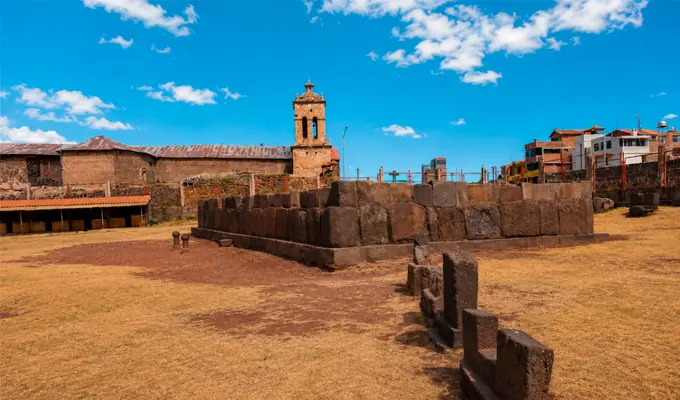
In the heart of the Puno Altiplano, surrounded by towering red rock formations and just a short distance from the majestic Lake Titicaca, lies one of Peru’s most mysterious and captivating landmarks: the Aramu Muru Gate, also known as the Hayu Marca Portal or the Gate of the Gods.
At first glance, it appears to be an impressive structure carved directly into solid rock. However, for those who visit, it is much more than that. For decades, this enigmatic site has fascinated archaeologists, travelers, and spiritual seekers drawn by the legends and mysteries surrounding it.
Although science has yet to unravel all of its secrets, Aramu Muru possesses a unique charm that blends ancient history, living folklore, and breathtaking natural scenery, making it an essential destination for anyone eager to experience the profound energy of the Andean Altiplano.
At first sight, the Aramu Muru Gate impresses visitors with its immense size. Measuring nearly seven meters (23 feet) high and seven meters wide, this monumental portal has been meticulously carved into a massive wall of red sandstone. At its center stands the iconic trapezoidal niche, a hallmark of Andean architecture, perfectly resembling a doorway that, intriguingly, leads nowhere, as it opens directly into the rock itself.
Rather than serving as a physical entrance to another chamber, archaeologists believe it was a sacred ceremonial site. Evidence suggests that ancient civilizations of the Altiplano carved this monument as a place of worship where rituals, offerings, and prayers honoring nature and spiritual forces were performed.
| Fact | Information |
| Location | Hayu Marca, Puno |
| Elevation | 3,900 m (12,795 ft) |
| Portal Height | 7 meters (23 ft) |
| Alternative Name | Gate of the Gods |
| Main Attraction | Rock-carved stone portal |
| Best Time to Visit | May to October |
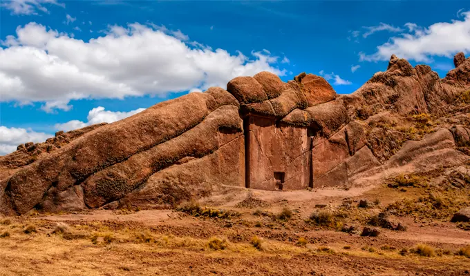
Reaching this mystical destination is an unforgettable experience. The portal is located in the community of Hayu Marca, within the district of Juli (El Collao Province), approximately 70 to 80 kilometers (43–50 miles) south of the city of Puno. It is surrounded by striking reddish rock formations and mountain landscapes overlooking the magnificent Lake Titicaca.
To help you plan your visit, here are the essentials: the site sits at an elevation of approximately 3,900 meters (12,795 feet) above sea level, in the heart of the Andean Altiplano. From downtown Puno, the journey takes between one and one and a half hours, making it an accessible day trip filled with spectacular scenery and a fascinating glimpse into Peru’s ancient cultural heritage.
One of the most fascinating aspects of Aramu Muru is that, to this day, historians and archaeologists have not been able to determine exactly who carved it or when it was created. It remains one of Peru's enduring archaeological mysteries.
What is known is that the Altiplano was home to powerful ancient civilizations, including the Pukara, Lupaca, the Aymara kingdoms, and later the Inca Empire. For this reason, researchers widely agree that this was never an ordinary place. Long before the Incas expanded across the Andes, these rock formations were already regarded as a sacred sanctuary, where different cultures gathered to honor their deities and connect with the spiritual power of the earth.
What truly surrounds this place with mystery is the legendary story of the priest from whom it takes its name: Aramu Muru.
According to oral tradition, during the turbulent arrival of the Spanish conquistadors, the wise priest fled Cusco carrying the most sacred treasure of his temple: a magnificent golden disk known as the "Key of the Gods". After a long journey across the Altiplano, he reached this enormous rock wall. There, he placed the golden disk into a small circular recess at the center of the portal. Miraculously, the stone opened, allowing him to pass into another dimension or sacred world from which he was never seen again.
Over time, this captivating legend has inspired travelers, mystics, and spiritual seekers from around the world, many of whom believe the monument is a genuine gateway to other realms. Although no archaeological evidence supports the story and it remains part of local folklore and popular belief, the legend undeniably adds a mystical atmosphere that makes standing before this monumental stone portal an unforgettable experience.
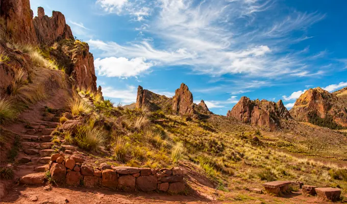
Standing before this remarkable monument, the first thing that captures your attention is the extraordinary precision of its craftsmanship. Every detail reflects the skill of its ancient creators. Here are its most striking features:
The greatest mystery, however, is that despite looking exactly like a doorway, the portal does not lead into any chamber or interior space. It is a doorway carved into solid rock that seemingly leads nowhere or perhaps somewhere beyond our understanding.
Over the years, Aramu Muru has become a magnet for travelers from around the world who are drawn by stories of spiritual energy, meditation, and unexplained phenomena.
Today, it is common to see visitors performing traditional Andean ceremonies of gratitude, seeking moments of quiet reflection, or simply immersing themselves in the profound peace offered by the breathtaking landscapes of the Andean Altiplano.
From a cultural perspective, the portal is respected as a sacred site deeply connected to the Andean worldview and the spiritual significance of the earth. Meanwhile, theories about interdimensional gateways belong to modern mysticism and popular belief. Although there is no scientific evidence supporting these claims, they undeniably add an aura of mystery and fascination that captivates everyone who visits.
Beyond the impressive stone portal itself, the surrounding area offers several attractions that make every step of the visit worthwhile:
If you're traveling from the city of Puno, reaching the site is relatively easy. You have several options depending on your travel style:
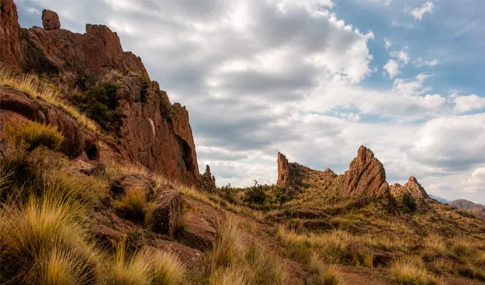
The dry season, which runs from May to October, is undoubtedly the best time to visit the Aramu Muru Gate. During these months, the Andean Altiplano offers its finest scenery, with brilliant blue skies, minimal rainfall, and ideal weather for outdoor exploration.
This is the perfect season to explore the site comfortably, enjoy breathtaking panoramic views, and fully appreciate the mystical atmosphere of this remarkable destination.
To make the most of your visit, keep these practical recommendations in mind:
Was the Aramu Muru Gate built by the Incas?
There is no conclusive archaeological evidence regarding its origin. Researchers believe the monument was carved and used by pre-Inca cultures of the Altiplano, such as the Lupaca or Tiwanaku civilizations, and was later adopted by the Incas as a sacred ceremonial site.
Why is it known as the "Gate of the Gods"?
The name comes from local legends and mystical traditions that describe the monument as a symbolic or sacred gateway to the realm of the Andean deities, known as Hanan Pacha.
Does the portal lead to a cave or hidden chamber?
No. It is a monumental structure carved directly into a solid rock face and does not lead to any cave, tunnel, or underground chamber.
Can it be visited year-round?
Yes. The site is accessible throughout the year. However, visiting during the dry season (May through October) offers the most enjoyable experience, with dry trails, clear skies, and excellent weather conditions.
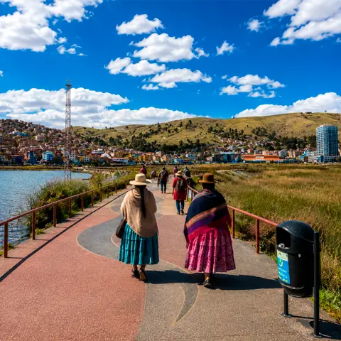
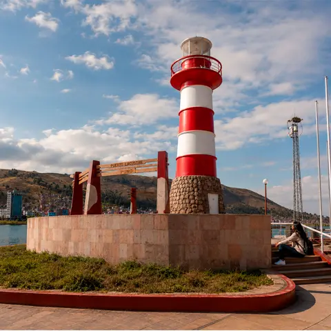
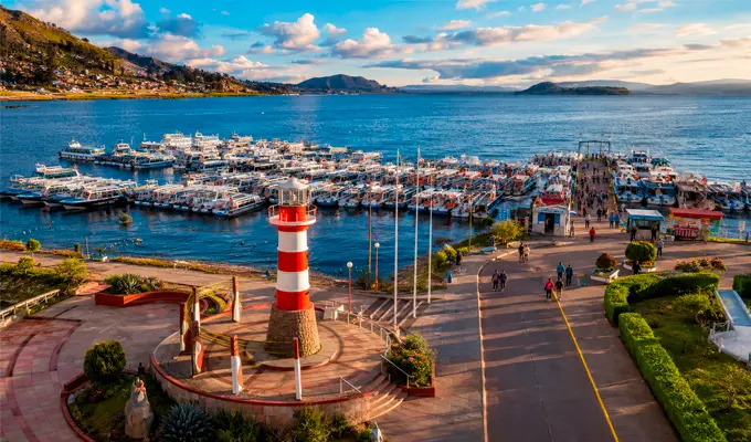
The Inca Bay Ecotourism Boardwalk is one of Puno’s most charming places. This beautiful lakeside promenade sits along the shores of Lake Titicaca, where nature, the fresh Andean air, and local life come together in perfect harmony. It is the ideal place to slow down, enjoy a leisurely stroll, and admire the vastness of the highest navigable lake in the world.
Best of all, it is located just a few minutes from the Main Square (Plaza de Armas), making it the perfect escape from the city's busy streets. It is an excellent spot to relax by the bay, observe the Andean birds that inhabit the lake, and capture some of the most breathtaking panoramic photographs of your trip.
The Inca Bay Ecotourism Boardwalk was created with a special purpose: to restore and revitalize this section of Lake Titicaca’s shoreline, transforming it into a green recreational area for both locals and visitors. The area was completely renovated with walking paths, cycling lanes, lighting, and comfortable resting areas that encourage visitors to spend time enjoying the scenery.
Today, it is one of Puno’s favorite places to unwind. Whether you prefer jogging, taking a peaceful walk, or simply sitting by the lake while watching the colors of the Andean sky reflect on the water, the boardwalk offers the perfect opportunity to relax while admiring the spectacular landscapes of the Altiplano.
The boardwalk is located in the city of Puno, stretching along the inner bay of Lake Titicaca. It lies within the Puno Region and Province at an altitude of 3,815 m (12,516 ft) above sea level. Thanks to its central location, approximately eight blocks from the Main Square (Plaza de Armas), it can easily be reached on foot from the historic center in about 10 minutes.
| Fact | Information |
| Location | Puno |
| Altitude | 3,815 m (12,516 ft) above sea level |
| Main Attraction | Lake Titicaca |
| Trail | Pedestrian boardwalk and cycling path |
| Distance | 10-minute walk from the Main Square |
| Best Time to Visit | May to October |
The boardwalk was developed through a major initiative led by Plan Copesco and several public institutions, aiming to restore this section of Lake Titicaca from both an environmental and tourism perspective. Its construction completely transformed the inner bay by adding pedestrian walkways, cycling lanes, green areas, and recreational spaces designed for visitors. More importantly, the project helped reduce the impact of wastewater that had affected the bay for years, restoring its natural beauty and improving the environmental health of this unique landscape.
Over the years, this effort has paid off. Today, the boardwalk has become one of Puno’s liveliest public spaces and a favorite gathering place where locals and visitors come together to enjoy everyday life along the shores of Lake Titicaca.
This scenic promenade offers something for everyone, regardless of age. Here are some of the best experiences you can enjoy during your visit:
One of the boardwalk's most fascinating features is the Sukankas (better known by many as Intihuatanas). These pre-Hispanic stone pillars were much more than simple monuments they functioned as sophisticated solar calendars.
Ancient Andean astronomers used them to carefully track the movement of the sun. By observing the shadows cast by these stone structures, they could accurately determine the changing of the seasons, allowing them to plan agricultural activities such as planting and harvesting, as well as important ceremonial events. These monuments also served a practical purpose by marking territorial boundaries between communities across the Altiplano.
Seeing these ancient structures standing beside Lake Titicaca is a remarkable reminder of the advanced astronomical knowledge developed in the Andes centuries ago.
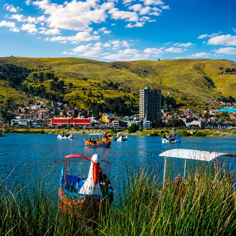
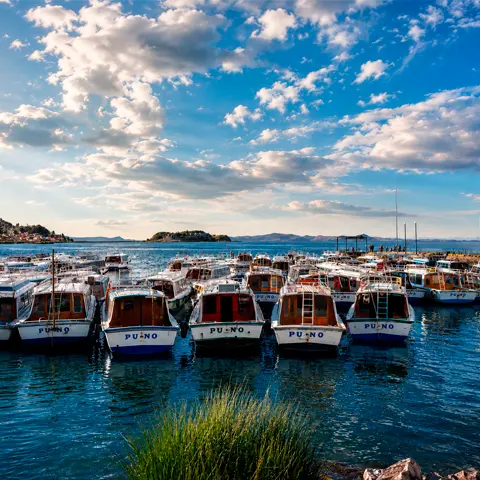
Despite being located close to the city, the boardwalk is a vibrant natural sanctuary that preserves the essence of Lake Titicaca. As you walk along the shore, you'll likely encounter the true residents of the bay: Andean ducks and gulls flying overhead, skilled grebes diving beneath the water, lively coots, and, depending on the season, beautiful migratory birds that use the bay as a resting stop during their journeys.
This remarkable birdlife thrives thanks to the extensive totora reed beds and wetland vegetation surrounding the bay. These native plants not only add vibrant greenery to the landscape but also play a crucial ecological role by naturally filtering the water while providing shelter, nesting areas, and food for numerous species. It is a delicate ecosystem that highlights the importance of protecting the natural environment of Lake Titicaca.
One of the best things about the boardwalk is its convenient location near downtown Puno. There are three easy ways to get there:
The boardwalk can be visited throughout the year, but if you're hoping for the clearest skies and the best panoramic views, plan your trip between May and October. This is the dry season in the Peruvian Altiplano, when bright blue skies create spectacular scenery around Lake Titicaca.
No matter when you visit, the best times of day are early morning and sunset. During these hours, the soft Andean light reflects beautifully across the lake, painting the surrounding mountains in brilliant shades of gold, orange, and red—perfect for photography or simply enjoying the peaceful atmosphere.
To make the most of your walk along the boardwalk while staying comfortable in the Altiplano climate, keep these practical tips in mind:
Is there an entrance fee to visit the Inca Bay Boardwalk?
No. Admission is completely free throughout the year, so you can visit whenever you like.
How long does it take to explore the boardwalk?
Most visitors spend between 30 minutes and one hour, depending on their pace, the number of photo stops, or simply how long they choose to relax by the lake.
Is the boardwalk suitable for families?
Absolutely. It is a safe and spacious recreational area with accessible walking paths, making it ideal for visitors of all ages, from young children to older adults.
What is the best time of day to visit?
The best moments are early in the morning and at sunset, when the lake is at its most peaceful and the light creates spectacular reflections across the waters of Lake Titicaca.
Talking about the Caballitos de Totora means exploring one of the oldest stories of resilience and ingenuity in Peru. These are far more than simple boats—they are a legacy of more than 3,000 years that has withstood the test of time. Beyond their practical function, these reed watercraft have become a true symbol of identity, cultural resilience, and adaptation to the natural environment. In fact, they achieve something remarkable: they create an invisible connection between two fascinating yet very different worlds—the Altiplano of Puno and the beaches of Peru’s northern coast.
In the region of Puno, life is inseparable from the legendary Lake Titicaca, the highest navigable lake in the world. In this Andean corner of Peru, totora reeds are much more than an aquatic plant they are the foundation of local survival, culture, and economy.
| Key Point | Description |
| Ancient Origin | The Caballitos de Totora have a history spanning more than 3,000 years and were created by ancient pre-Inca civilizations. |
| Construction Material | They are made from totora reeds, a durable, buoyant, and biodegradable aquatic plant that is also used to build homes and floating islands. |
| Use on Lake Titicaca | They serve as a traditional means of transportation and fishing for the lake’s communities, especially the Uros people. |
| Tradition in Huanchaco | On Peru’s northern coast, the fishermen of Huanchaco continue to use them every day for artisanal fishing, preserving a tradition that dates back more than 2,000 years. |
| Cultural and Tourism Value | The Caballitos de Totora are an important symbol of Peruvian identity and a major tourist attraction in both Puno and the La Libertad region. |
| Living Heritage | They represent an ancestral legacy passed down from generation to generation and, in Huanchaco, they have been recognized as National Cultural Heritage. |
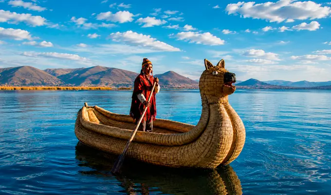
The history of these watercraft dates back to the pre-Inca civilizations that inhabited the region thousands of years ago. These ancient peoples carefully observed the reeds growing along the shores of the lake and discovered their unique qualities: exceptional natural buoyancy, remarkable water resistance, ideal flexibility for weaving, and ease of harvesting and drying. Using these characteristics, they developed construction techniques so ingenious that they have been proudly passed down from generation to generation and continue to be practiced today.
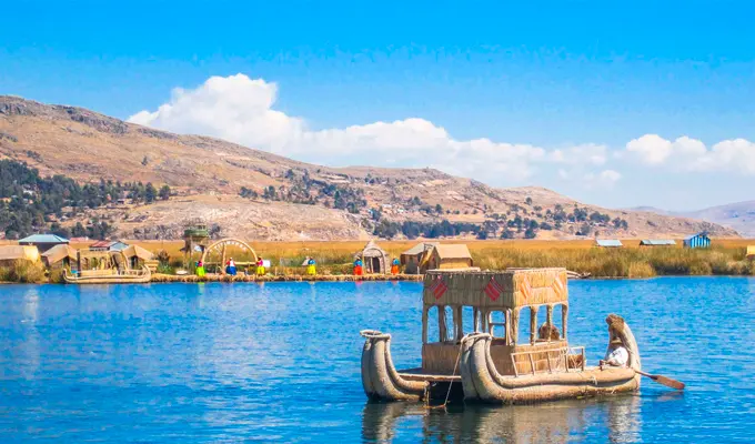
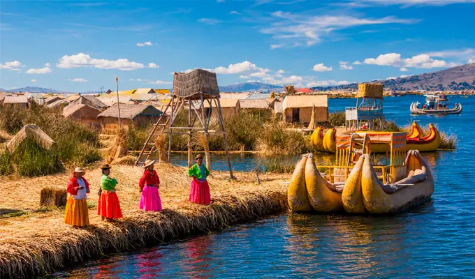
One of the most remarkable examples of this ancestral heritage is the existence of the Uros Floating Islands. These extraordinary islands are built entirely from totora reeds, forming stable artificial platforms where families live, work, and preserve their traditions. What makes this ecosystem truly fascinating is that the same material serves countless purposes: it is used to build traditional homes, create beautiful handicrafts, construct boats, and even form the floating surfaces on which people live. In this unique environment, the Caballitos de Totora become the essential means of transportation and fishing, allowing residents to navigate the lake with ease.
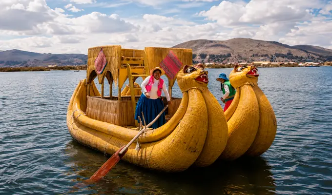
Building these traditional watercraft is a highly specialized artisanal process. It begins with harvesting totora reeds from the wettest areas of Lake Titicaca, followed by a natural drying process that reduces their internal moisture. Once ready, the reeds are bundled into compact sections, carefully tied together, and shaped by hand into their distinctive elongated form. Finally, the structure is progressively reinforced with additional layers of reeds, resulting in not only a practical vessel but also a true masterpiece of ancestral craftsmanship.
These traditional highland boats can reach several meters in length and are carefully designed to safely support the weight of a fisherman along with all of their equipment. Although they are remarkably lightweight, they also reflect the challenges of working with natural materials. Since totora is organic, it gradually deteriorates when exposed to water, requiring continuous maintenance through the periodic replacement of its outer layers.
Among their most outstanding qualities is the fact that they are completely eco-friendly and biodegradable vessels, built entirely through traditional craftsmanship without machinery. They are perfectly suited for artisanal fishing and represent an enduring cycle of care, renewal, and harmony with nature.
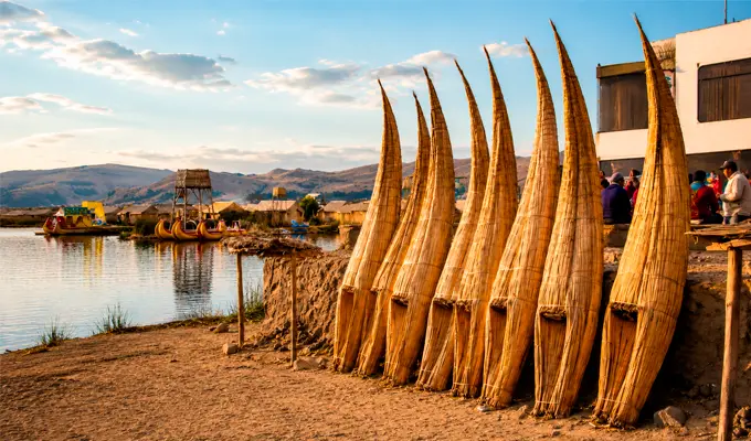
Today, Lake Titicaca is not only home to an extraordinary traditional way of life but also one of Peru’s leading cultural tourism destinations. Travelers from around the world are drawn by the opportunity to sail aboard these traditional reed boats, visit the famous floating islands, learn directly from the ancient Uros culture, and take part in authentic cultural experiences that leave lasting memories. It is living proof that when a tradition is preserved with dedication and pride, it becomes a bridge connecting the past with the entire world.
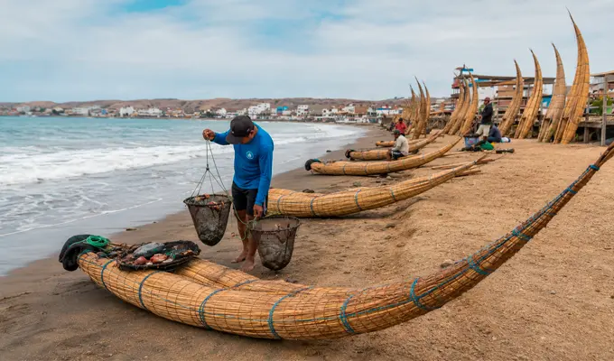
Although many people primarily associate these traditional reed boats with the landscapes of the Puno Altiplano, the truth is that their most iconic, vibrant, and enduring use can be found along Peru’s northern coast, especially throughout the shoreline of the La Libertad region. Near the city of Trujillo, and most notably in the seaside town of Huanchaco, the Caballitos de Totora continue to play an essential role in artisanal fishing to this day. They represent a living cultural tradition that has survived uninterrupted for more than two thousand years.
On the beaches of Huanchaco, these traditional watercraft are not static museum exhibits or relics of the past—they remain an essential part of everyday life. Local fishermen, respectfully known as the “men of the caballito”, continue to venture into the Pacific Ocean aboard these handcrafted reed vessels. Every journey demonstrates remarkable skill and courage, inherited directly from the ancient Moche and Chimú civilizations.
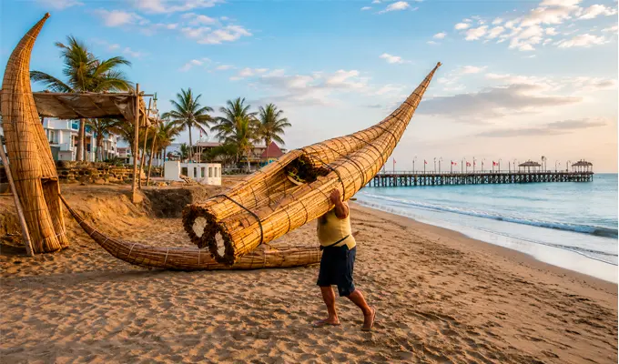
This fascinating tradition traces its origins back to the ancient societies that once flourished along Peru’s northern coast. The Moche civilization, in particular, carefully depicted similar reed boats in their ceramics and clay reliefs, illustrating their use for both daily fishing and maritime trade. Despite centuries of historical change, this custom never disappeared. Instead, it has endured because its techniques and knowledge have been proudly passed down from generation to generation.
Unlike the calm waters of the Andean highlands, the reed boats used along Peru’s northern coast are specifically designed to withstand the powerful waves of the Pacific Ocean. Their daily use includes essential activities such as artisanal fishing, skillfully navigating through breaking waves, transporting fishing nets and equipment, and returning swiftly to shore once the day's work is complete. Fishermen launch directly from the beach, riding through the surf with remarkable expertise, demonstrating an extraordinary mastery of and respect for the sea.
The immense historical, social, and cultural significance of the Caballito de Totora in Huanchaco has earned it official recognition as part of Peru’s National Cultural Heritage. Beyond this distinction, Huanchaco has established itself as one of the most important destinations along Peru’s northern tourist routes. Every year, visitors from around the world come to witness this ancient tradition in action, a living testament to the enduring identity of Peru’s northern coast, still written upon the waves.
Lake Titicaca is far more than a geographical landmark; it is a vast and mystical inland sea that lies at the heart of the Collao Plateau, shared in sacred harmony by Peru and Bolivia. Since ancient times, it has been regarded as one of the most sacred spiritual centers in South America. Its deep blue waters have witnessed the birth, flourishing, and evolution of remarkable Andean civilizations such as the Pucará, Tiwanaku, and Inca over thousands of years. Its fascinating history is a living tapestry where archaeological discoveries blend seamlessly with enduring ancestral traditions and legendary origin stories that continue to inspire generation after generation.
Located at an impressive altitude of more than 3,810 meters (12,500 feet) above sea level, Lake Titicaca proudly holds the title of the highest navigable lake in the world. Yet its true wonder also lies in its immense age. It is considered one of the world's few ancient lakes, with a geological history estimated at nearly three million years. This extraordinary longevity has allowed a unique ecosystem to flourish while creating a breathtaking landscape where the Andean sky seems to merge with eternity.
The fascinating history of Lake Titicaca dates back millions of years, long before the first human settlements and the rise of the great Andean civilizations. Geological studies reveal that this immense body of water was formed by powerful tectonic movements and faults within the Earth's crust. As the Andes Mountains gradually rose, water became trapped inside a vast enclosed basin, giving birth to what is now South America's most iconic lake.
Over millions of years, dramatic climate changes, glaciations, and geological transformations gradually shaped the Andean Altiplano. These natural processes carved out the deep basin that now holds the lake, continuously replenished by the melting snow and glaciers of the surrounding mountains. Thanks to its remarkable age, Lake Titicaca belongs to the exclusive group of the world's "ancient lakes." Unlike most lakes, which are geologically young and disappear relatively quickly, Titicaca has endured through geological eras while preserving much of its original hydrological characteristics and its exceptional natural environment.
| Aspect | Key Information |
| Origin and Significance | Lake Titicaca is approximately 3 million years old, stands at 3,810 meters (12,500 feet) above sea level, and is recognized as the highest navigable lake in the world as well as one of Earth's oldest lakes. |
| Geological Formation | It was formed through tectonic activity and the uplift of the Andes Mountains. Its basin is continually fed by meltwater from the surrounding snow-capped peaks. |
| Historical and Cultural Importance | It served as the heart of major Andean civilizations such as the Pucará, Tiwanaku, and Inca, becoming an important political, religious, and commercial center. |
| Andean Mythology | According to tradition, Viracocha, the creator god, as well as Manco Cápac and Mama Ocllo, the legendary founders of the Inca Empire, emerged from its sacred waters. |
| Archaeological Heritage | More than 20 submerged archaeological sites have been discovered beneath its waters, containing gold, silver, ceramics, and Spondylus shells that reveal the lake's ceremonial significance. |
| Present-Day Importance | Lake Titicaca remains one of the top tourist destinations in Peru and Bolivia, featuring attractions such as the Uros Floating Islands, Taquile Island, and Amantaní Island, where ancient traditions and community-based tourism continue to thrive. |
Several ancient myths are associated with Lake Titicaca, including the following:
Long before the Inca Empire expanded across the Andes, several highly sophisticated cultures settled along the shores of Lake Titicaca, attracted by its abundant natural resources, favorable microclimate, and strategic location as a major regional trade hub.
Archaeological research shows that human occupation of the Altiplano dates back thousands of years, evolving from early hunter-gatherer societies through formative cultures such as Chiripa and Pucará before reaching its greatest level of sophistication with the rise of the Tiwanaku State. Between approximately AD 600 and 1050, Tiwanaku transformed the Lake Titicaca Basin into one of the most important political, religious, and commercial centers in pre-Columbian South America.
To sustain a large population despite the harsh climate and frequent frosts of the Altiplano, Tiwanaku engineers developed advanced agricultural technologies, most notably the waru waru, or raised fields. This ingenious system of interconnected water channels surrounding elevated planting platforms acted as a natural thermal regulator, absorbing heat during the day and gradually releasing it at night to protect crops from freezing temperatures. Thanks to these innovations and their remarkable stone architecture, Tiwanaku became one of the most influential civilizations in pre-Hispanic South America, leaving behind a technological and cultural legacy that the Incas would later adopt and expand.
As the Incas expanded the borders of the Tahuantinsuyo into the Collasuyo region, they encountered a land where the sacredness of Lake Titicaca was already deeply rooted in the traditions and beliefs of local communities. Rather than suppressing these ancient customs, the rulers of Cusco demonstrated remarkable political and religious insight by incorporating existing myths into the official Inca worldview. In doing so, they strengthened the legitimacy of their own divine origin by linking it directly to the sacred birthplace of the Andean world.
To honor this spiritual connection, the Incas transformed the lakeshore into a magnificent center of state worship by building temples, shrines, and administrative complexes at strategic locations. Among these, the Island of the Sun (formerly known as the Island of Titiqaqa) became the most sacred ceremonial center in the entire empire. Members of the Inca elite—including the Sapa Inca himself—made pilgrimages to this sanctuary to pay tribute to the sacred rock where they believed the Sun first emerged.
The depth of this devotion is reflected not only in historical chronicles and the impressive ruins that remain on land, but also in the treasures preserved beneath the lake itself. Over the past few decades, underwater archaeological expeditions have uncovered extraordinary ritual offerings in areas such as the Khoa Reef, near the Island of the Sun. Among the most remarkable discoveries are:
The depths of Lake Titicaca conceal a fascinating underwater museum that continues to amaze archaeologists and researchers around the world. Far from revealing all its mysteries, the lake remains the focus of ongoing scientific investigations that constantly reshape our understanding of the ancient Andes.
During recent decades, advanced underwater archaeological expeditions have mapped and documented more than twenty submerged archaeological sites, recovering thousands of priceless pre-Hispanic artifacts that once belonged to the Tiwanaku and Inca civilizations. These discoveries demonstrate that centuries of fluctuating water levels, combined with the intentional practice of depositing ceremonial offerings beneath the lake, transformed its waters into one of the world's most sacred underwater repositories.
Among the most celebrated discoveries is an intact Inca stone offering box, recovered several meters below the surface at Khoa Reef. When conservation specialists carefully opened the container, they found:
Both artifacts carried profound symbolic meaning within the Inca Empire. Reserved exclusively for the imperial elite, they were closely associated with rituals of reciprocity, the legitimization of imperial authority, and ceremonies dedicated to the deities of water and fertility.
These remarkable underwater discoveries not only enrich the cultural heritage of Peru and Bolivia, but also provide compelling archaeological evidence that, for centuries, Lake Titicaca functioned as the most important sacred aquatic sanctuary in the Andes—a mystical place where the human and divine worlds met beneath the water's surface.
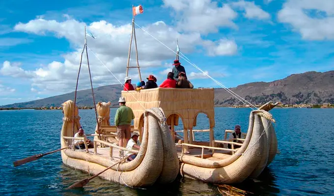
Exploring the lake's famous islands allows travelers to experience lifestyles that have endured for centuries. Three destinations stand out for their extraordinary cultural value:
Beyond its importance as a tourist destination, Lake Titicaca remains the cultural heart of the Quechua and Aymara peoples who inhabit its shores and peninsulas. For them, the lake is far more than a natural resource for fishing and agriculture—it is Mamacocha, a living sacred being deserving of respect, reciprocity, and reverence, just as it has been for thousands of years.
The historical significance of Lake Titicaca is truly extraordinary. More than simply a geographical landmark, it is a unique place where nature, mythology, archaeology, and living culture converge. Its importance can be understood through five exceptional characteristics: